 vesseltracker.com
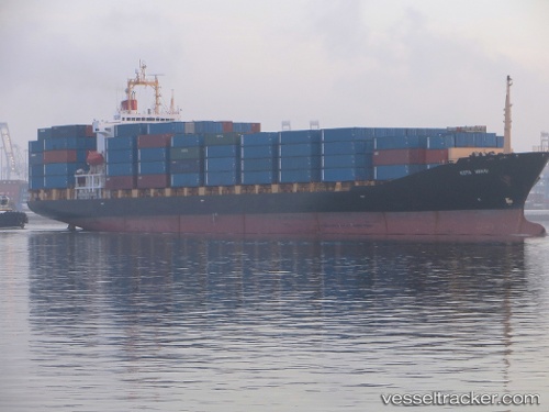
Vessel HR FARHA IMO: 9123582, MMSI: 405000337 Container Ship
UTC, 6.94597, 79.83096, course: 270, speed: 0.1
UTC, 6.94592, 79.83112, course: 270, speed: 0
2026-02-01 07:33:48 UTC, 6.94593, 79.83094, course: 270, speed: 0
Live AIS position:
UTC. Near Colombo),
updated 2026-02-01 07:33:48 UTC.
Find the position of the vessel HR FARHA on the map. The latter are known coordinates and path.
marine traffic ship tracker show on live map
The current position of vessel HR FARHA is 6.94593 lat / 79.83094 lng. Updated: 2026-02-01 07:33:48 UTCCurrently sailing under the flag of Bangladesh
HR FARHA built in 1996 year
Deadweight:
24657 tDetails:
Last coordinates of the vessel:
UTC, 6.94594, 79.83079, course: 271, speed: 0UTC, 6.94597, 79.83096, course: 270, speed: 0.1
UTC, 6.94592, 79.83112, course: 270, speed: 0
2026-02-01 07:33:48 UTC, 6.94593, 79.83094, course: 270, speed: 0